

Another passenger on the flight to Kotzebue stopped at my row and introduced himself as Colin Arisman. Colin is an award-winning filmmaker. We had exchanged emails but had not met in person. I invited him to sit in my empty row so that we could chat about Alaska and his film projects. Almost as an afterthought, I mentioned that I was carrying a drone on this trip (“half the weight of my DSLR”), but not good at using it. Did he have any guidance for me? He did! His first piece of advice was to shoot around midnight when the light was low. I didn’t do that … wasn’t willing to get out of the tent. But I followed his other tips and got great clips for the following video.
I noticed some striking ridges and domes in northwestern Alaska while exploring satellite imagery:


This part of Alaska formed as a ‘fold and thrust belt,’ where large swathes of layered sedimentary rock were pushed northward, sometimes folding, sometimes thrusting upward on faults. Here’s a video of the process in a lab. Subsequent erosion sliced through the folds, creating the puzzling patterns visible in the imagery.
Sarah, Will Koeppen, and I visited the southern limit of these features last year, and we were so impressed with the good travel and abundance of wildlife that we considered scrapping our itinerary and just floating to the coast—despite not having brought maps of that area. But we stuck to the plan (kind of), and decided to save northward travel for another year.
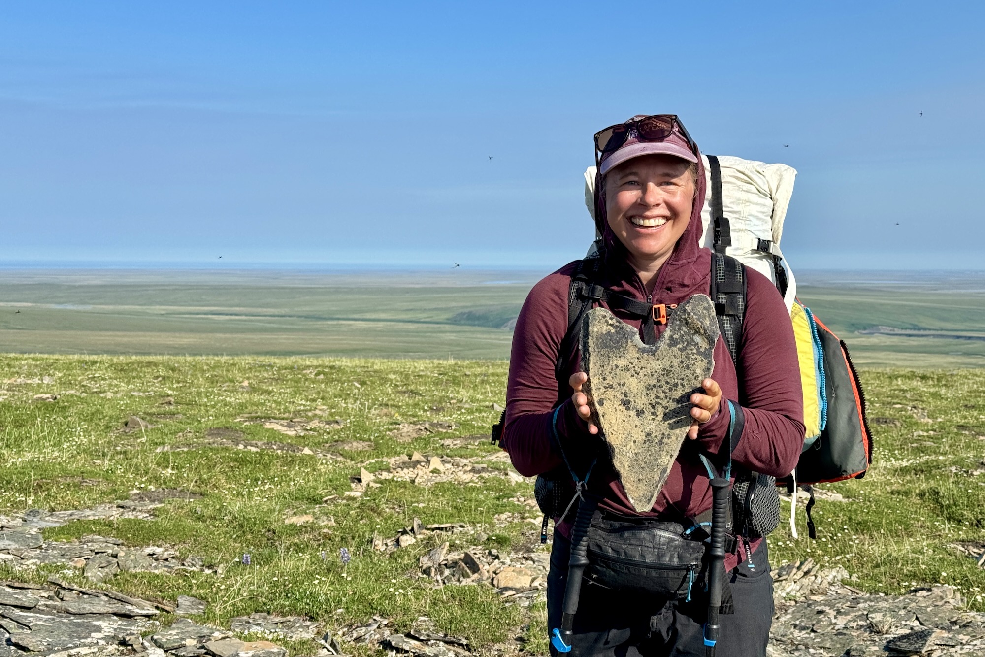
Part of the appeal of these ridges is that the human history is so … believable. The ridges call out, ‘Walk me!’ Nomadic peoples walked these ridges to escape the mosquitoes and watch caribou and mammoths graze the grasslands. I’ve never had such a strong sense of relating to travelers coming across the Beringia Land Bridge. More recent visitors have found signs of these passages in scatter piles (flakes of chert chipped in the process of making arrowheads and spear tips) and other archeological sites.
Sarah got a jumpstart on the season and did some hiking in the area with a couple of girlfriends before I flew in to join them. You can read about their trip here. Pat Gault flew in with me, and the girlfriends flew out on our flight. Pat was hankering for a solo trip, but we convinced him to stick around and put up with our schedule and routines. This was Sarah’s and my eighth trip into the Brooks Range, so our systems and decision-making are pretty dialed. But Pat was an easy third wheel, not very attached to any specific itinerary. Pat is also extremely capable, having just retired from twenty years as a rescue professional. I captured some of his very insightful perspective in this podcast episode.
Most of our trips involve a lot of hiking followed by a long float to an exit point. This trip was an exception: we hiked for 2 days, paddled for 3, hiked for 2.5, paddled for 2.5, hiked for 1, and finished with a one-mile lagoon crossing. Pretty cool, except that our packweight was pretty heavy to start—especially Pat’s, because his gear is more hunting oriented than ultralight. I’ve been dealing with a knee injury and didn’t feel strong enough to take any of Pat’s weight, so he just carried a heavier load. And didn’t complain about it.
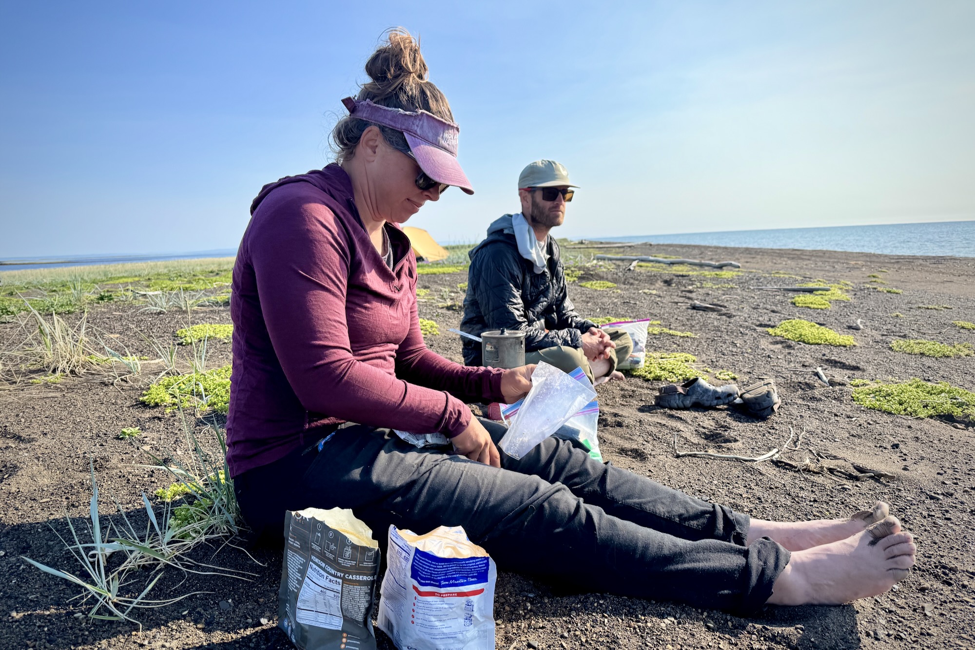
Sarah had been in the mountains for twelve days when we arrived, so she was in great hiking shape. Sarah set the pace and led us from the airstrip toward the headwaters of the Kokolik River (Iñupiat: bistort, an abundant edible plant). But not before taking a day in camp to catch up on conversation and calories—I brought Moose’s Tooth pizza, salad, nectarines, peas, cherries, and baked treats from the Fire Island Bakery.
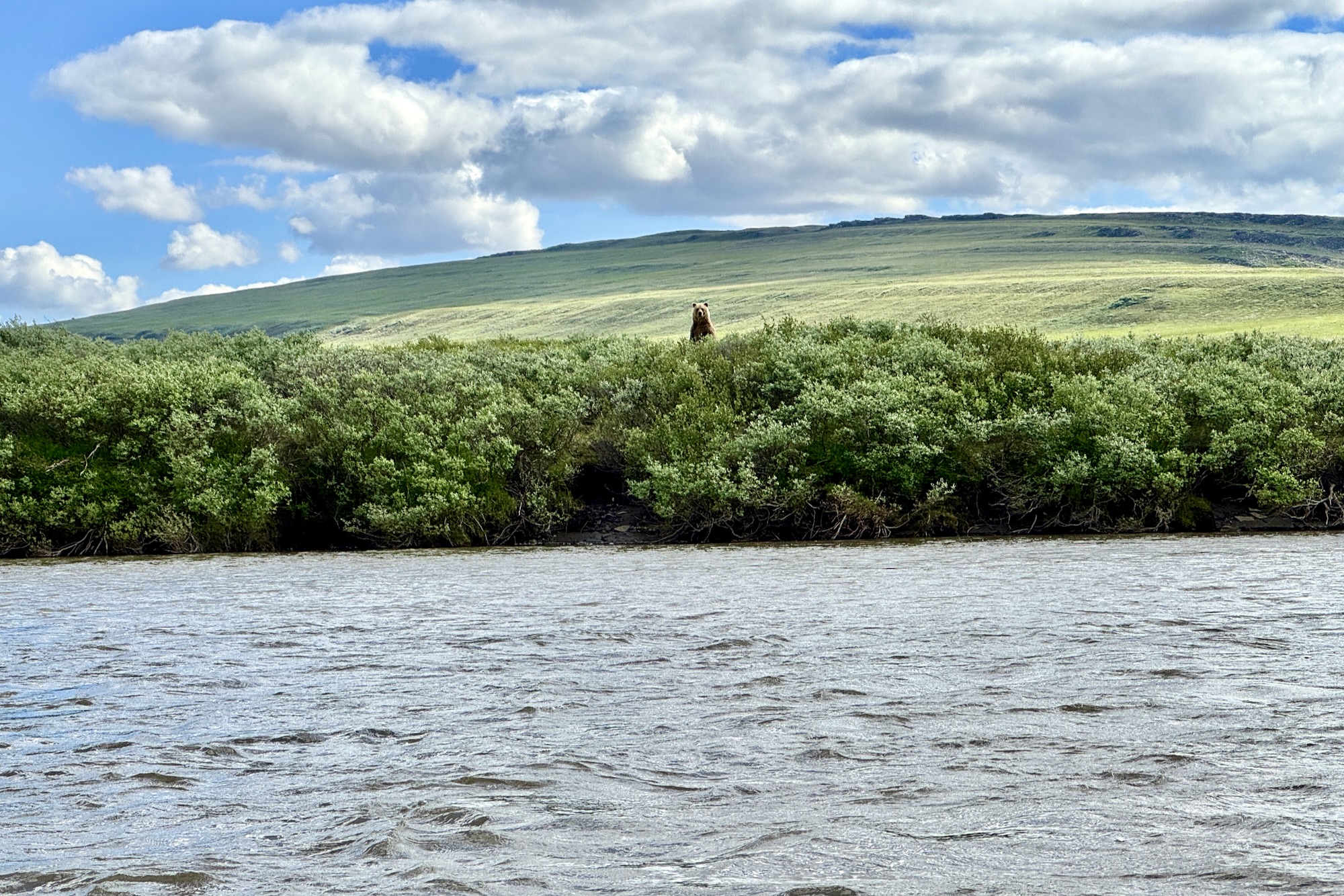
Sarah’s headstart also sharpened her ‘backcountry eyes.’ We’ve recognized this before … that we get better at spotting things during a trip, and that this improved perception is slowly lost back in town. Sarah pointed out bears and birds’ nests as Pat and I mostly had our heads down and struggled to keep our legs moving. Speaking of bears, we saw five grizzlies from camp on day zero! Sarah and I were at our tent when we noticed Pat jogging toward us from a nearby ridge. I said, “I don’t think Pat is a jogger. He must have seen a bear.” He’d seen three.

Our packs were the heaviest they would be, so we had modest mileage goals for day one. Sarah led us over good walking and low passes to a perched campsite that she was excited to revisit. Our route brought us over another cool feature I had noticed in the satellite imagery and identified as landslide debris lobes. Hig suggests: Rather than lobes, those are hummocks – likely molards, permafrost blocks that degraded after the landslide emplaced them.

Here’s a drone view with Pat and Sarah for scale:

Sarah’s campsite was marked by a grizzly ‘stomp trail.’ These are always a treat to find, and this was one of the best we’ve seen. Stomp-walking is a distinct gait used by bears to spread scent from glands in their paws. Check out this video for an example. They retrace and smear their steps, eventually creating deep depressions that mark their passage and territorial boundaries.


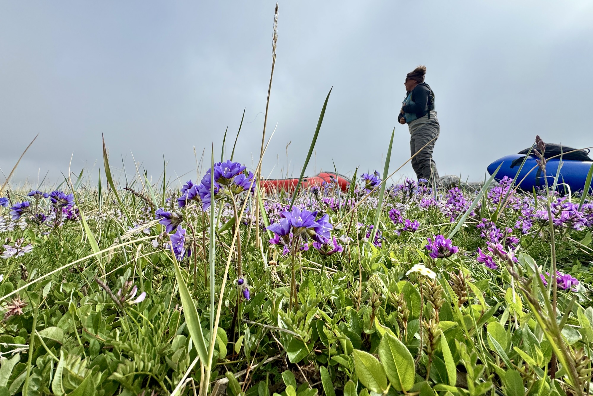
We spent the next day with packrafting’s three h’s: hemming, and hawing about whether there was enough water to float, and then hiking a short distance before repeating the hemming and hawing. We stopped just short of the first significant tributary, unwilling to pass up a beautiful dryas and wildflower bench.


The tributary had less water than we hoped, but we justified switching to packrafts with the expectation that floating the loaded boats on leashes (‘walking the dog’) would be more pleasant than carrying the weight on our backs. The water was cold and clear, with a few fun rapids but nothing fast or uncomfortable. I loved watching the exposed rocks drift by.


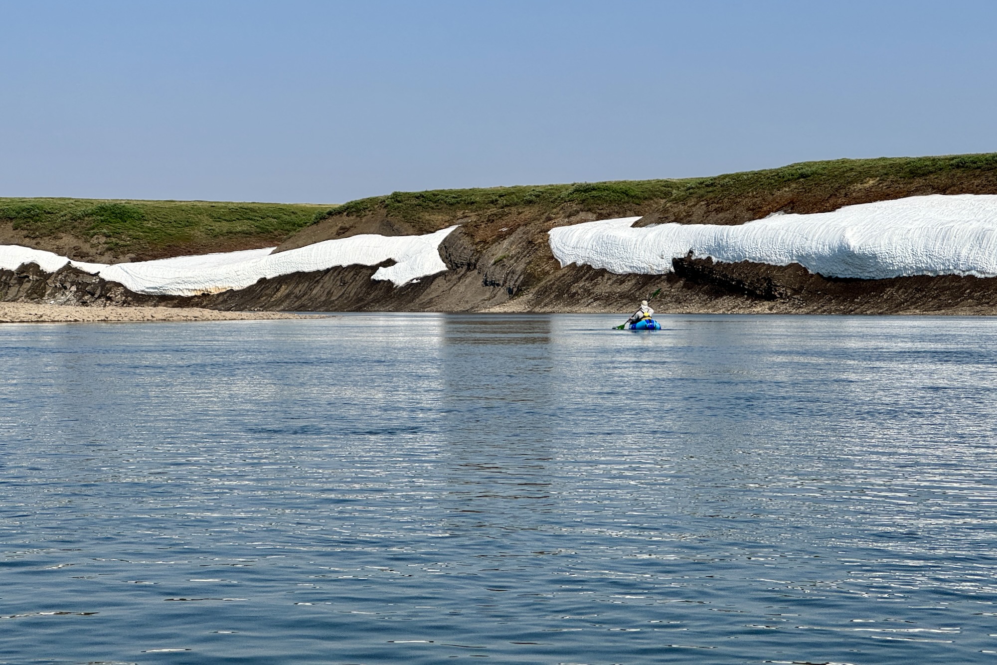
The next significant tributary was the Iligluruk River, which, brown and swollen, quadrupled the river volume. This was a surprise. The added depth and speed were welcome, but it was sad to give up the clear water of the upper Kokolik.


This section of the river was a treat. The gradient kept us moving, and we soon cut through the first ridge system. The fact that these rivers slice right through the ridges was a key in our decision to travel this route. We thought the floating might be slow, but at least it would be interesting. Each river bend rewarded us with a view of new cutbanks, ridges, and collapsing permafrost. We also saw a group of three and then twelve muskox (you can get a quick glimpse in my trip video).


We set up camp early so that we could hike into the hills. I’m especially appreciative of getting to walk several miles along a single geologic layer because I studied geology in school, but Pat and Sarah were impressed as well. This was something like mall-walking, and we casually gained 800 feet and a nice view of the surrounding ridges.
Two rough-legged hawks dive-bombed us at one point, and looking over the ridge, we spotted a nest with four fuzzy hawk chicks waiting for a food delivery.


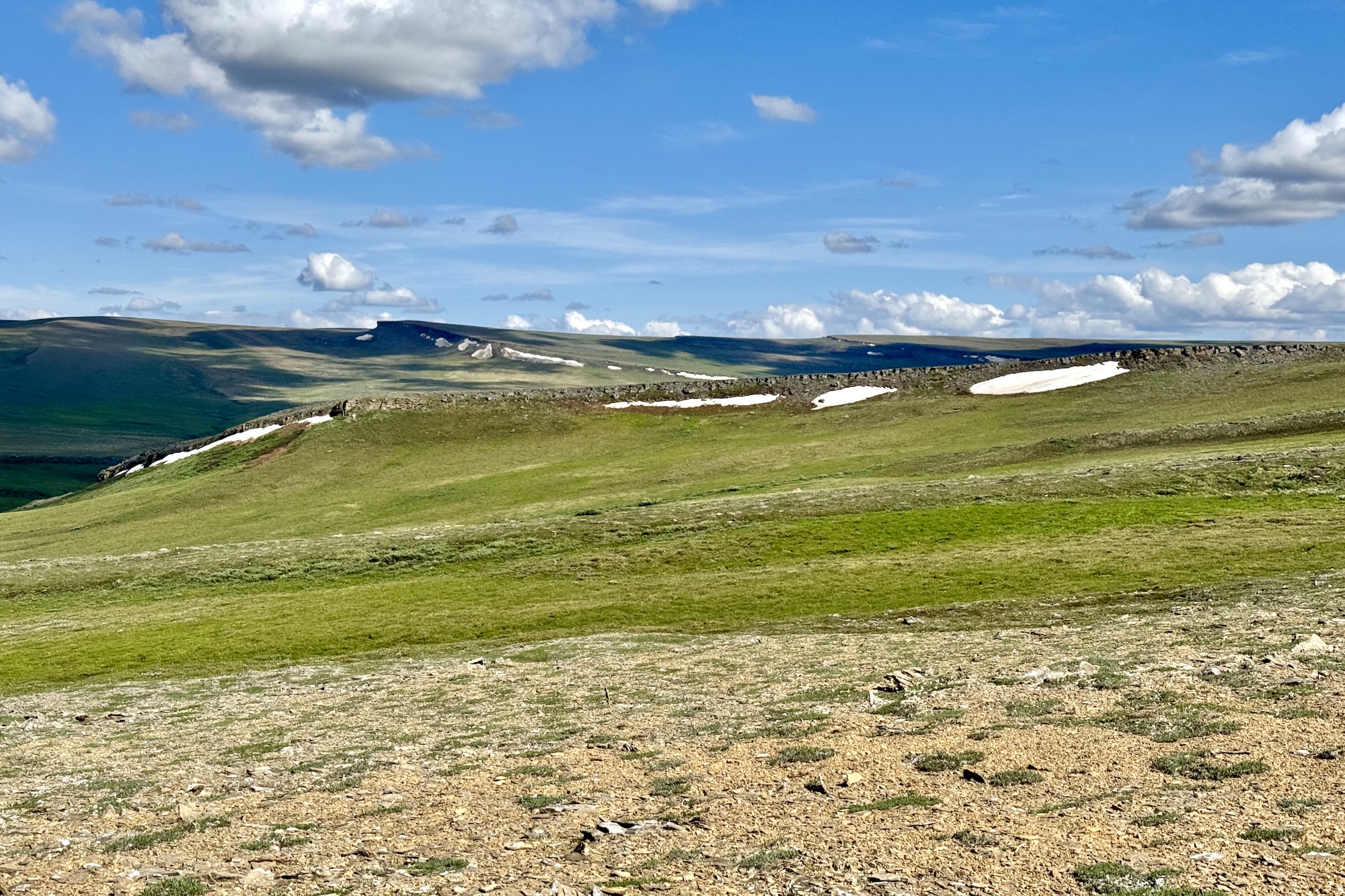
The river remained interesting all the way to the Amatusuk Ridge. This was a decision point, but not really, because the decision was so easy to make. We could stay on the Kokolik for 150 miles of progressively more meandering and slower water, or hike the ridge for 20 miles to reach the shorter and more direct Kukpowruk (Iñupiat: fairly large stream).
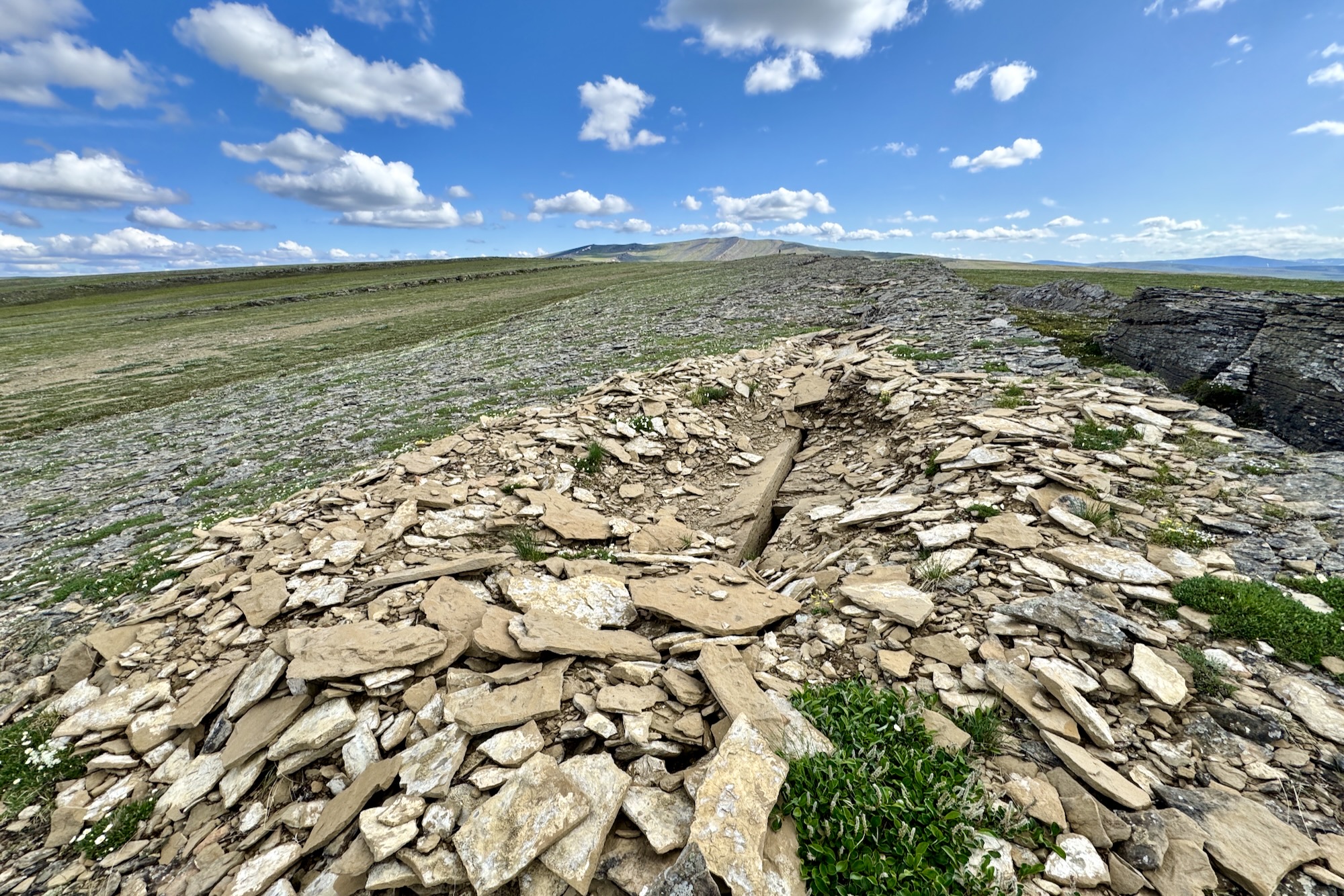
The Amatusuk ridge was a highlight. We slowed our pace to enjoy easy travel in the high country. A pleasant breeze kept us cool and the mosquitoes away. We’d walk along a layer of rock until it became vegetated or lower than the ridge crest, then cross a short distance through tussocks to the next band of exposed rock, and continue onward. I brought my drone for this section, anticipating that the scale could be captured best from the air, but I never succeeded.
The best walking was along sandy layers that had eroded to brown, hard-packed soil. The gray bands were limestone, a slower surface to walk on due to the blocky and loose nature of the rocks. But a few sections of limestone consisted of flat plates, and these were a real treat—like walking cobblestone streets. I say that, but I don’t think I’ve ever walked cobblestone streets.
Life was hot on the ridge, and we had to work to collect water. But the breeze, views, and pleasant travel were worth it. We found a muskox skull and watched a wolverine lope.


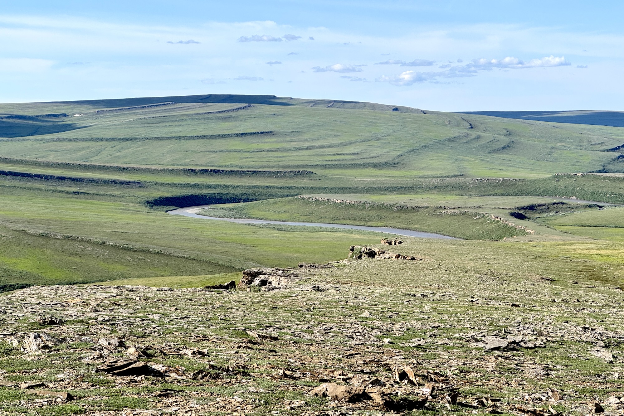
We followed the curvature of the ridge down to the valley floor and were thrilled to find a deep pool at the confluence of the Deadfall Creek and the Kukpowruk. I was confused by the ‘deadfall’ name since there are no trees in the area, but it was named (by the USGS) after a deadfall trap was seen there. We swam and washed our clothes and bodies.
Things get tricky here. The Kukpowruk River is on ASRC land (Arctic Slope Regional Corporation), which has unclear regulations for visitors. I made several calls but was unable to speak with anyone at ASRC about what was allowed. Their website says to contact ASRC before floating the river, and this is the right thing to do, or at least try.
Due to the land status ambiguity, we stayed on the Kukpowruk River and didn’t do any side hiking. The river still had a decent gradient for the first ten miles, but then slowed significantly. We adjusted to earlier starts to avoid the headwinds that picked up in the afternoons.
Despite the slow gradient, the river remained interesting. We saw countless goslings and hawks, and one hawk carrying a gosling. The riverbanks commonly exposed bedrock, including layers of coal. There was even a surf wave created by a layer of coal.
The water was disturbingly warm, and we swam throughout the day and at camp to stay cool.


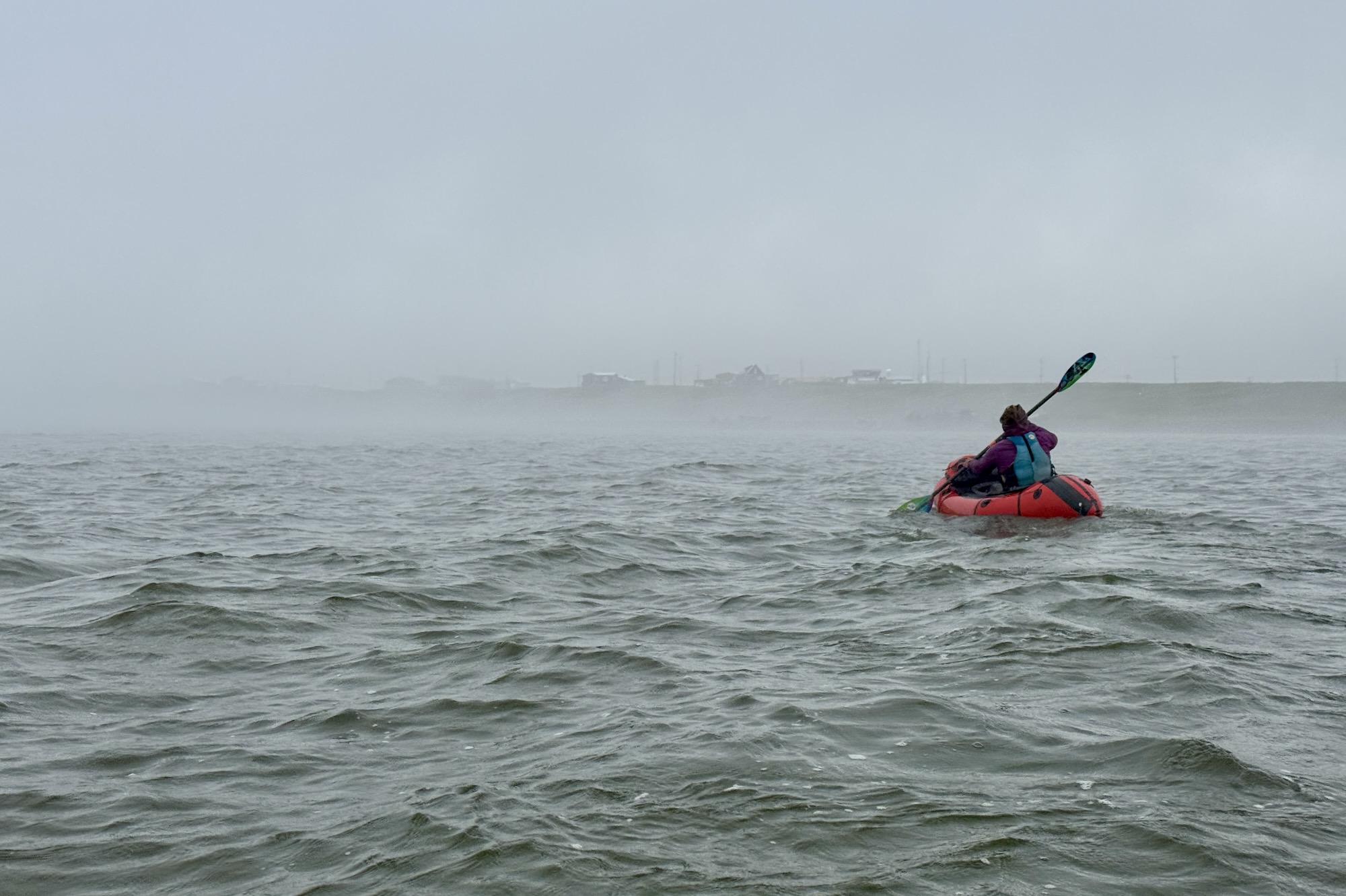
The Kukpowruk flows into the Kasegaluk Lagoon (Iñupiat: having spotted seal) about ten miles south of the village of Point Lay. We started paddling toward the barrier islands across the lagoon, but soon grounded out. Sarah and I had experienced this once before, near the village of Kaktovik, so we were somewhat prepared. We towed our boats while walking through the calf-deep muck. The key was to keep moving. With momentum, the next step was easy. But any downtime meant literal down time, and the suction of the mud threatened to steal our shoes.
After a half-mile of walking through the lagoon, we were able to paddle the final mile to the barrier island.


We had checked ahead of time to make sure there wouldn’t be a walrus haulout during our visit—we wouldn’t have been welcome or safe. Here’s a video of what the haulout looks like, and some interviews with folks in Point Lay.
Conditions were incredible at the barrier island. The beach consisted of small pebbles instead of sand, and the dark pebbles had absorbed the heat from the 24-hour sun exposure. The ocean breeze and lack of standing water made for a nearly complete absence of mosquitoes. We sprawled out and enjoyed a lovely evening.

Just before crawling into the tent for the night, Sarah pointed out a snowmachine track piled up on the beach. It didn’t quite look like a track, so we wandered over and discovered … a walrus carcass. The carcass stunk even though it had been picked clean by scavengers. It made us wonder about the possibility of critters coming through during the night. Not exactly what you want to discover right before bed.
Walking along the barrier island was surreal, especially with sea fog in the morning. The island is about 100 yards wide and extends to the horizon. We saw caribou and ATV tracks, gulls and terns.


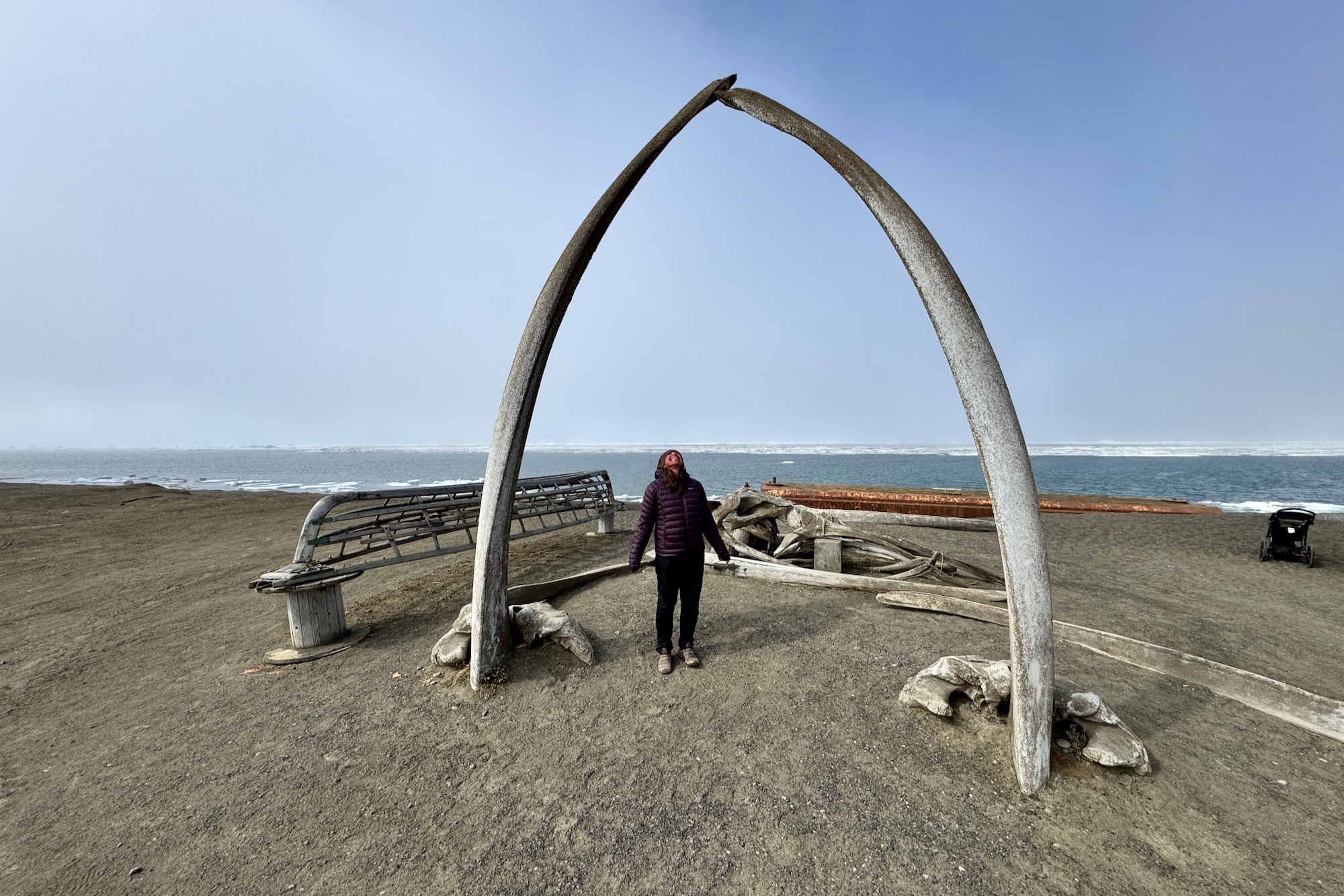
We walked eight miles along the beach, and I soon realized that there were too many carcasses for me to stop and inspect each one. A few of the walruses still had their tusks, which I’d never seen before—ivory is typically collected by the locals to make into jewelry or art. We also saw seal and whale bones. Apparently, this is where marine mammals come to die.


We watched a whale spouting during a snack break. A whale biologist on our flight to Utqiagvik guessed that it was a gray whale based on our description. The biologist had been in Point Lay for their annual beluga harvest—23 whales this year!
We pulled out our packrafts to cross a gap in the island and again to cross the island to the new location of the village of Point Lay. The original village, Kali (Iñupiat: mound), was located on a mound on the barrier island. The village moved across the lagoon to avoid flooding hazards 20 or 30 years ago.
The guidelines for visitors to Point Lay are unclear. The land is owned by the village, and Pat called the village office to make sure we were welcome, but he received the phone call equivalent of a shrug. So, we didn’t know what to expect.
Our welcome was wonderful. A mother and son were pulling their boats out of the lagoon when we arrived, and they stopped to ask where we’d come from. She ended up sending her son back with the ATV and a bag with three apples to take me to the water plant so I could fill our bottles. He had been part of the beluga hunt and was proud of harvesting a few himself.
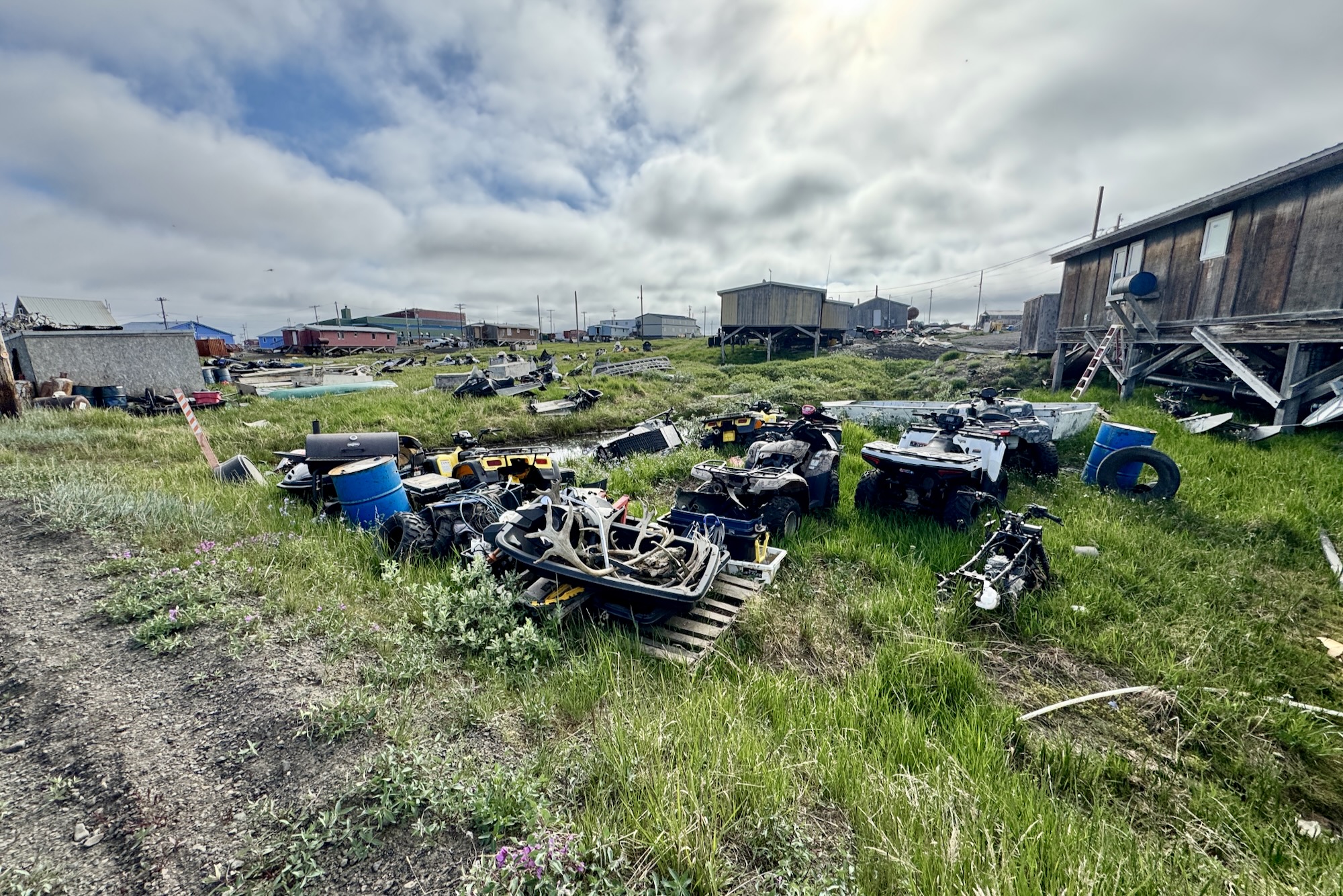
We walked through town and then set up camp near the airport. A lot of the town looks shiny and new. Kids were out on bikes, adults were walking the streets. The bugs were bad, so we pitched our tents and hid.
We had a few mixed interactions with folks in town, some who said we needed permission to be within fifty miles of town, or that outsiders weren’t welcome, but other folks were excited to hear about what we had seen on the rivers. Here too, a phone call to the village office is the right thing to do, even if you don’t get much of a response.
Our trip finished with a sprint, literally. Our flight receipt listed a departure time of 10:45 AM. A call to Wright’s Air Service in Fairbanks at 8 AM said that there were no flights until mid-afternoon. That sounded like bad data, so we called again at 9 AM and got transferred to the Utqiagvik office, which said to call back at noon. I had a strong enough cell signal to download a flight tracking app and confirmed that there were no Wright’s planes in the area. But we decided to move our camp to the airstrip early ‘just in case.’ Sarah and I walked back into town, and when I grabbed my phone to tell Pat that the store was open, I was surprised to see five messages from the previous five minutes:

This was an hour before we were supposed to call for an update! Sarah and I started fast-walking back, and then running! The State Trooper pulled up and offered us a ride the rest of the distance (Sarah asked, “Is this the second time you’ve been in the back of a police car?”). The pilot was unsympathetic about having to wait for us, even though Wright’s communication had been terrible, and it was pure luck that Pat was at the strip when the plane landed.
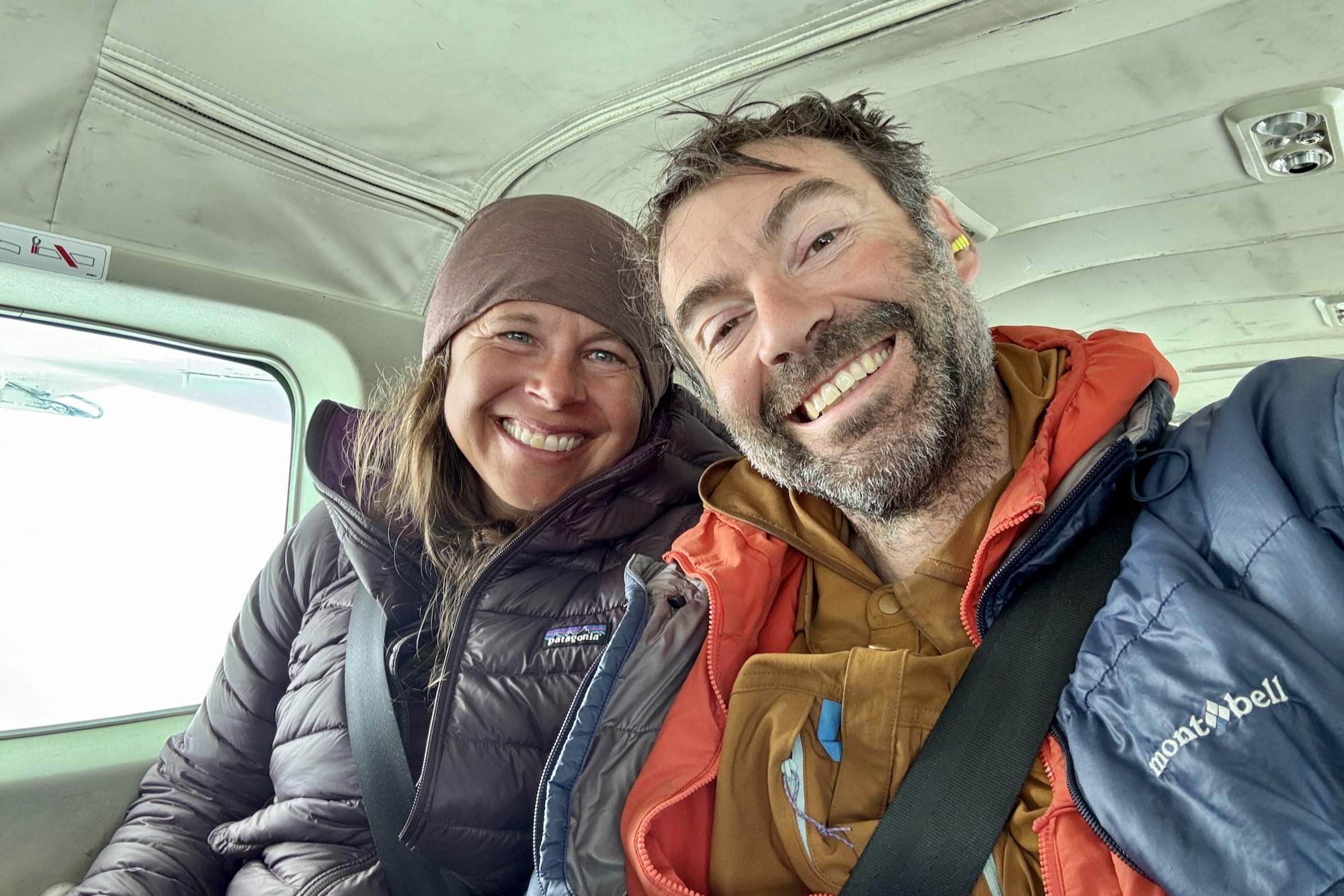
We spent a few hours exploring Utqiagvik and ate at an excellent Korean restaurant. Sarah and I flew home to Anchorage, and Pat realized that he had accidentally purchased a ticket for the next day, so he spent the night in town.

Pat’s extra day in Utqiagvik turned into two more good restaurant meals, a friend-of-a-friend showing him old sod homes, coastal erosion, and looking at traditional trade routes on paper maps spread over the kitchen floor. Pretty good treatment for a third wheel—we were jealous.
I’d like to go back. I’d like to walk more of the ridges. Most of our route was in the NPR-A region (National Petroleum Reserve – Alaska), where visiting regulations are easy and clear. The NPR-A is also under constant threat of development. This was a unique opportunity to see both sides of the development and climate change coin: eroding permafrost banks, too-warm water, traditional food harvest, and villages and visitors that depend on oil. Welcome to the Arctic.
Fantastic! I always love reading your trip reports and living vicariously through your lens and writing!
This looks like such a great place to hike. Thanks for sharing another awesome adventure.
…any chance of sharing route kml/gpx file? Or waypoint of starting airstrip? 🙂 Which operator out of Kotz dropped you off?
Flown back and forth over that area for years admiring those bizarre ridges.
What has worked for us is to have an area of interest and then call the charter services to ask where they can land. Some strips aren’t available at some times, others might be in the area that we don’t know about, etc. For the NW Arctic, we’ve flown with Arctic Backcountry and Golden Eagle, both based in Kotzebue.
This site hasn’t been as helpful as I expected, but … in theory: https://tundrapilot.com/
As always, wonderful trip report.
I’ve often thought that those ridgelines up there, and as far east as the Etivlik, are the best walking in Alaska (https://en.wikipedia.org/wiki/National_Petroleum_Reserve%E2%80%93Alaska#/media/File:NPRA_southwest_synclines_ridges_and_hikers.jpg).
We also saw a bunch of marmots on our long walk in 2006 at that same mountain along the Kokolik (https://packrafting.blogspot.com/2012/03/last-minute-silly-season-planning.html). Apparently those are descendants of a population that survived the last Age separated fro the other marmot populations farther south. Not sure if they are considered different “species” by the marmot geneticists, but they are certainly different–Arctic rather than alpine marmots.
ADF&G on the Alaska marmot (https://www.adfg.alaska.gov/index.cfm?adfg=alaskamarmot.rangemap), a separate species from the more familiar hoary marmot of south central Alaska (https://www.adfg.alaska.gov/index.cfm?adfg=hoarymarmot.main).
good article and photos of a place I’ll never go to see. Interesting that grizzly stomping in a vast area where few people go. regards from Australia